Skip to main content
Search form
Search
New Inventory
General Collection
The Back Room
Events & Articles
Events
Articles
Newsletter Signup
We Buy Maps
About
Contact
Nautical Chart / Ocean Chart
Pages
1
2
next ›
last »
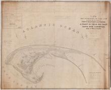
A Map of The Extremity of Cape Cod, 1836
A Mapp of the Sommer Islands Once Called the Bermudas, c. 1627-1631
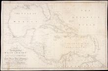
A New General Chart of the West Indies and the Coast of America, 1840
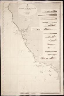
America West Coast, Diego Bay to Cape Mendocino 1855.62
Chart of St. Lawrence & Saguenay Rivers 1873.
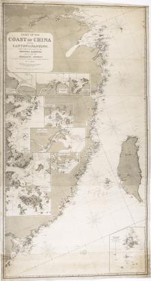
Chart of the Coast of China, 1865
Haro and Rosario Straits, Surveyed by Capt. G.H. Richards & The Officers of H.M.S. Plumper, 1858-9
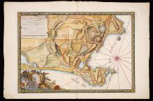
Icon Sinus Baiarum , 1772
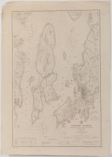
Newport Harbor, Rhode Island 1896
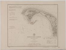
Provincetown Harbor, Massachusetts 1891
Pages
1
2
next ›
last »
Main menu
New Inventory
General Collection
The Back Room
Events & Articles
Events
Articles
Newsletter Signup
We Buy Maps
About
Contact
New Inventory
General Collection
The Back Room
Events & Articles
Events
Articles
Newsletter Signup
We Buy Maps
About
Contact
Search form
Search