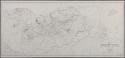
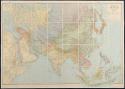
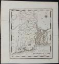
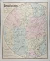
General Collection
The General Inventory is the largest inventory of Original Antique Maps and includes unusual and fine maps from the 18th, 19th and 20th century. In this section you will find antique geographic surveys, map atlases, school geographies, reports of travel and discovery, celestial charts, ocean and nautical charts, railroad maps, soil maps, and urban land use plans to name a few. There are also scenic bird's eye views. From the 19th and 20th century you will find boldly colorful pictorial maps, thematic maps and advertising maps and broadsides.
April 15, 2018 was the first publication of Original Antique Maps on the web. Each month from that day forward you will find new inventory added to the Original Antique Maps web site. New acquisitions and new inventory will be published under the heading "New Inventory" and will be added to General Inventory and The Back Room. Archived material will also be updated.
If you have specific wants or you have questions about a map or other work presented on the Original Antique Maps web site, I encourage you to contact me directly by telephone or email.
Displaying 1 - 20 of 96