Skip to main content
Search form
Search
New Inventory
General Collection
The Back Room
Events & Articles
Events
Articles
Newsletter Signup
We Buy Maps
About
Contact
Civil Engineering
Pages
« first
‹ previous
1
2
3
next ›
last »
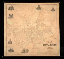
Map of the City of Salem, Mass. From An Actual Survey H.McIntyre 1851.
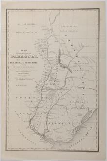
Map of the Republic of Paraguay, With the Adjacent territories of Brazil, Uruguay and the Argentine Republic, Showing the Valley of the Rio De La Plata. 1851
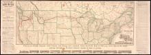
Map of the Rocky Mountain Region Showing Forest Areas and Irrigation Ditches in 1885.
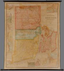
Map of the State of Rhode Island and Providence Plantations. Henry F. Walling Civil Engineer 1855.
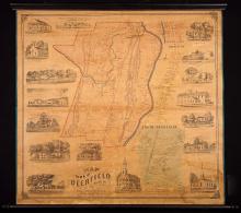
Map of the Town of Deerfield, 1855
Map of the Town of South Kingstown Washington Co. Rhode Island From Actual Surveys under the direction of Henry F. Walling 1857
Military Map of the United States, 1951
Military Maps illustrating the Operations of the Armies of the Potomac & James May 4th 1864 to April 9th 1865 -unique provenance-First Edition
Mitchell's Reference and Distance Map of the United States 1845
New and Correct Map of the Lines of the Northern Pacific Railroad, Fall 1883
Pages
« first
‹ previous
1
2
3
next ›
last »
Main menu
New Inventory
General Collection
The Back Room
Events & Articles
Events
Articles
Newsletter Signup
We Buy Maps
About
Contact
New Inventory
General Collection
The Back Room
Events & Articles
Events
Articles
Newsletter Signup
We Buy Maps
About
Contact
Search form
Search