Skip to main content
Search form
Search
New Inventory
General Collection
The Back Room
Events & Articles
Events
Articles
Newsletter Signup
We Buy Maps
About
Contact
Land Use
Pages
« first
‹ previous
1
2
3
Mitchell's Reference and Distance Map of the United States 1845
New York, 1964
NEW-YORK.(nd) c. 1877- 1892 Bird's Eye View - Scarce
Plan of Boston Proper Showing Changes in Street And Wharf Lines 1795 To 1895
Plan of the Village of Augusta, Maine 1838
Provincetown Harbor, Massachusetts 1891
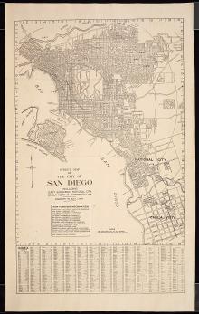
San Diego, 1914
The Central Part of Boston, Massachusetts, Boston Elevated, 1930
The City of New York, Fortune, 1939
World War II: European Area, 1947
Pages
« first
‹ previous
1
2
3
Main menu
New Inventory
General Collection
The Back Room
Events & Articles
Events
Articles
Newsletter Signup
We Buy Maps
About
Contact
New Inventory
General Collection
The Back Room
Events & Articles
Events
Articles
Newsletter Signup
We Buy Maps
About
Contact
Search form
Search