Skip to main content
Search form
Search
New Inventory
General Collection
The Back Room
Events & Articles
Events
Articles
Newsletter Signup
We Buy Maps
About
Contact
Region
Pages
1
2
3
4
next ›
last »
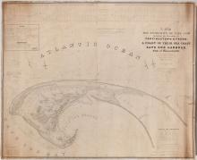
A Map of The Extremity of Cape Cod, 1836
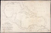
A New General Chart of the West Indies and the Coast of America, 1840
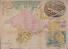
A New Map of the Crimea and Sea of Azof,1856
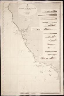
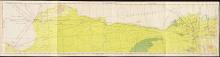
America West Coast, Diego Bay to Cape Mendocino 1855.62
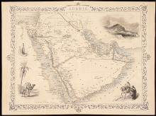
Arabia, c. 1850
Bengasi, Libya to Cairo, Egypt FC 67, WWII Flight Chart, U.S. Army 1945
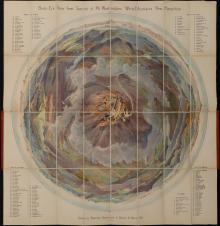
Bird's Eye View from Summit of Mt. Washington; White Mountains, New Hampshire. (c.1902) - First Edition, unique provenance
Birds Eye View of Casco Bay 1905 - with WWII manuscript Mosquito Eradication Plan drawn on the map
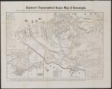
Engineer's Topographical Range Map of Sevastopol, c.1856
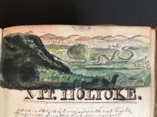
Gratia Denny Friendship Album 1826-1832 (manuscript)
Pages
1
2
3
4
next ›
last »
Main menu
New Inventory
General Collection
The Back Room
Events & Articles
Events
Articles
Newsletter Signup
We Buy Maps
About
Contact
New Inventory
General Collection
The Back Room
Events & Articles
Events
Articles
Newsletter Signup
We Buy Maps
About
Contact
Search form
Search