Skip to main content
Search form
Search
New Inventory
General Collection
The Back Room
Events & Articles
Events
Articles
Newsletter Signup
We Buy Maps
About
Contact
Pictorial Map
Pages
« first
‹ previous
1
2
3
4
next ›
last »
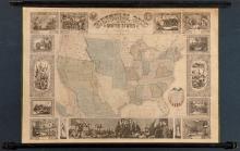
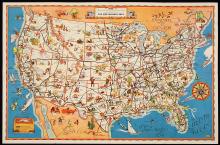
Pictorial Map of the United States 1847
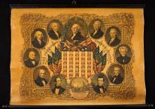
Portraits of the Presidents, 1846
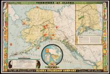
Territory of Alaska, The Alaska Line 1936
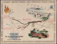
The 79th Infantry Division, WWII Pictorial Maps, 1945 (set of 4)
The Atlantic Shore Line Railway and Connections. 1908
The Central Part of Boston, Massachusetts, Boston Elevated, 1930
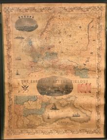
The European Battle Fields! 1854
The Greyhound Lines, c. early 1930's
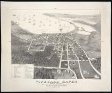
Vineyard Haven. Dukes County. Martha's Vineyard, Massachusetts. [Tisbury](c.1893?)
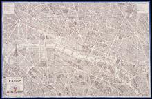
Vue du Centre de Paris, 1951
Pages
« first
‹ previous
1
2
3
4
next ›
last »
Main menu
New Inventory
General Collection
The Back Room
Events & Articles
Events
Articles
Newsletter Signup
We Buy Maps
About
Contact
New Inventory
General Collection
The Back Room
Events & Articles
Events
Articles
Newsletter Signup
We Buy Maps
About
Contact
Search form
Search