Skip to main content
Search form
Search
New Inventory
General Collection
The Back Room
Events & Articles
Events
Articles
Newsletter Signup
We Buy Maps
About
Contact
Survey
Pages
« first
‹ previous
1
2
Map of The New York Wilderness and The Adirondacks, 1874
Map of the Rocky Mountain Region Showing Forest Areas and Irrigation Ditches in 1885.
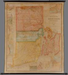
Map of the State of Rhode Island and Providence Plantations. Henry F. Walling Civil Engineer 1855.
Map of the Town of Dartmouth Bristol County Mass. 1856
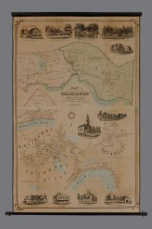
Map of the Towns of Salisbury & Amesbury Essex County, Mass. 1854
Plan of Boston Proper Showing Changes in Street And Wharf Lines 1795 To 1895
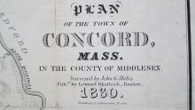
Plan of the Town of Concord, Mass. 1830/1835
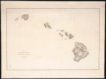
United States Exploring Expedition. Lot of 15 Individually Published South Seas navigation charts. Capt.Charles Wilkes U.S. Navy calling card with manuscript ink inscription.
Pages
« first
‹ previous
1
2
Main menu
New Inventory
General Collection
The Back Room
Events & Articles
Events
Articles
Newsletter Signup
We Buy Maps
About
Contact
New Inventory
General Collection
The Back Room
Events & Articles
Events
Articles
Newsletter Signup
We Buy Maps
About
Contact
Search form
Search