Skip to main content
Search form
Search
New Inventory
General Collection
The Back Room
Events & Articles
Events
Articles
Newsletter Signup
We Buy Maps
About
Contact
Massachusetts
Pages
1
2
3
next ›
last »
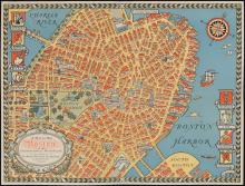
The COLOUR of An OLD CITY A MAP of Boston by Edwin Olsen & Blake Clark, artists 1926
A Map of Old Boston in The Commonwealth of Massachusetts Presented by the Boston Five Cent Savings Bank 30 School Street Boston (1929)
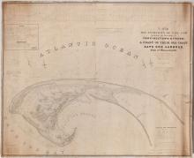
A Map of The Extremity of Cape Cod, 1836
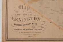
A Map of the Town of Lexington, Middlesex County, Mass. 1853
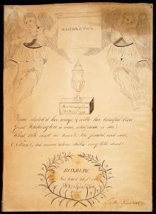
Abraham S. Fox, hand drawn Tribute and Mourning piece to George Washington, created at Roxbury, Free School Feb. 8, 1800.
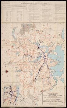
Boston Elevated Railway System Route Map, c. 1944
Boston, 1857, Charles Mottram engraver, after J.W.Hill, unique printer's proof edition
Charles River. (c.1906)
Holden, c.1838 (engraved at Lahainaluna, Hawaii, Sandwich Islands)
Map of Boston and Its Vicinity, 1859
Pages
1
2
3
next ›
last »
Main menu
New Inventory
General Collection
The Back Room
Events & Articles
Events
Articles
Newsletter Signup
We Buy Maps
About
Contact
New Inventory
General Collection
The Back Room
Events & Articles
Events
Articles
Newsletter Signup
We Buy Maps
About
Contact
Search form
Search