Skip to main content
Search form
Search
New Inventory
General Collection
The Back Room
Events & Articles
Events
Articles
Newsletter Signup
We Buy Maps
About
Contact
City or Town
Pages
1
2
3
4
5
next ›
last »
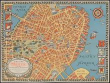
The COLOUR of An OLD CITY A MAP of Boston by Edwin Olsen & Blake Clark, artists 1926
A Map of Old Boston in The Commonwealth of Massachusetts Presented by the Boston Five Cent Savings Bank 30 School Street Boston (1929)
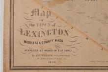
A Map of the Town of Lexington, Middlesex County, Mass. 1853
A Map of the Towns of Dorchester and Milton, 1831.
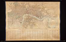
A New Map of London, 1829.
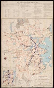
Boston Elevated Railway System Route Map, c. 1944
Boston, 1857, Charles Mottram engraver, after J.W.Hill, unique printer's proof edition
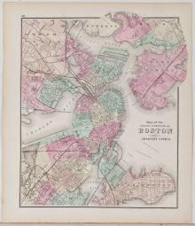
Boston, 1873
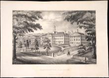
DARTMOUTH COLLEGE. First Edition [nd 1834-1835]
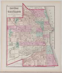
Gray's Map of Chicago, 1873
Pages
1
2
3
4
5
next ›
last »
Main menu
New Inventory
General Collection
The Back Room
Events & Articles
Events
Articles
Newsletter Signup
We Buy Maps
About
Contact
New Inventory
General Collection
The Back Room
Events & Articles
Events
Articles
Newsletter Signup
We Buy Maps
About
Contact
Search form
Search