Skip to main content
Search form
Search
New Inventory
General Collection
The Back Room
Events & Articles
Events
Articles
Newsletter Signup
We Buy Maps
About
Contact
Politics
Pages
1
2
3
4
next ›
last »
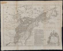
A Map of the British and French Settlements in North America, c. 1755
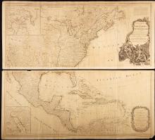
A New Map of North America with the West India Islands Divided According to the Preliminary Articles of Peace, Signed at Versailles 20 Jan. 1783, publ. 1786
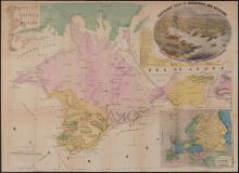
A New Map of the Crimea and Sea of Azof,1856
Abraham Lincoln, Portrait Photograph, 1860 and 1881
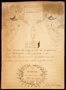
Abraham S. Fox, hand drawn Tribute and Mourning piece to George Washington, created at Roxbury, Free School Feb. 8, 1800.
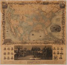
American Republic, 1863
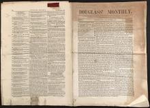
Douglass' Monthly. November, 1860.
Excerpts From Visions of Cody (Signed and numbered First Edition) by Jack Kerouac
GEORGIA. (1808), Daniel Sturges, Surveyor General (Manuscript)
Liberty. In the form of the Goddess of Youth giving Support to the Bald Eagle.1796
Pages
1
2
3
4
next ›
last »
Main menu
New Inventory
General Collection
The Back Room
Events & Articles
Events
Articles
Newsletter Signup
We Buy Maps
About
Contact
New Inventory
General Collection
The Back Room
Events & Articles
Events
Articles
Newsletter Signup
We Buy Maps
About
Contact
Search form
Search