Skip to main content
Search form
Search
New Inventory
General Collection
The Back Room
Events & Articles
Events
Articles
Newsletter Signup
We Buy Maps
About
Contact
Railroad and Transportation
Pages
1
2
3
4
5
next ›
last »
MAUI HAWAIIAN ISLANDS. 1885.1903., Molokai, 1897, Oahu Hawaiian Islands, 1902, Kauai Hawaiian Islands 1903, HAWAII HAWAIIAN ISLANDS 1901,Lanai Government Survey 1878
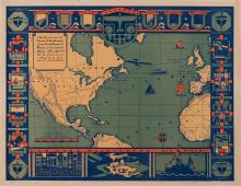
The Flight of Charles A Lindberg from New York to Paris in his monoplane "The Spirit of St. Louis" - on May 20-21, 1927
A Map of the Towns of Dorchester and Milton, 1831.
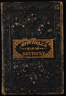
A New Map of Kentucky, 1857
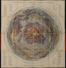
Bird's Eye View from Summit of Mt. Washington; White Mountains, New Hampshire. (c.1902) - First Edition, unique provenance
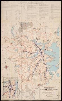
Boston Elevated Railway System Route Map, c. 1944
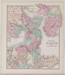
Boston, 1873
Chart of St. Lawrence & Saguenay Rivers 1873.
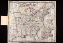
Colton's Route-Book Through the United States of America and the Canadas, 1850.
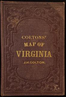
Colton's Virginia, Pocket Map, 1861
Pages
1
2
3
4
5
next ›
last »
Main menu
New Inventory
General Collection
The Back Room
Events & Articles
Events
Articles
Newsletter Signup
We Buy Maps
About
Contact
New Inventory
General Collection
The Back Room
Events & Articles
Events
Articles
Newsletter Signup
We Buy Maps
About
Contact
Search form
Search