Skip to main content
Search form
Search
New Inventory
General Collection
The Back Room
Events & Articles
Events
Articles
Newsletter Signup
We Buy Maps
About
Contact
State
Pages
1
2
next ›
last »
A New Map of Kentucky, 1857
Charles River. (c.1906)
Colton's Virginia, Pocket Map, 1861
Death of Major Ringgold, 1846
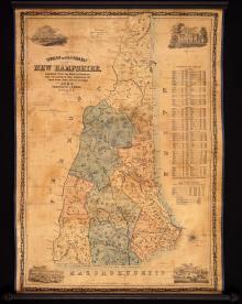
Dodge's Map of New Hampshire, 1854, Second Edition
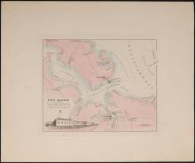
Fort Monroe And Vicinity [Virginia] c. 1860
Geological Map of the Lake Superior Land District in the State of Michigan
GEORGIA. (1808), Daniel Sturges, Surveyor General (Manuscript)
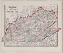
Gray's Kentucky and Tennessee, 1873
Map of Rhode Island Showing State, County and Town Boundaries. 1906 - mammoth folding map
Pages
1
2
next ›
last »
Main menu
New Inventory
General Collection
The Back Room
Events & Articles
Events
Articles
Newsletter Signup
We Buy Maps
About
Contact
New Inventory
General Collection
The Back Room
Events & Articles
Events
Articles
Newsletter Signup
We Buy Maps
About
Contact
Search form
Search