Skip to main content
Search form
Search
New Inventory
General Collection
The Back Room
Events & Articles
Events
Articles
Newsletter Signup
We Buy Maps
About
Contact
Commerce
Pages
1
2
3
next ›
last »
A Map of the Towns of Dorchester and Milton, 1831.
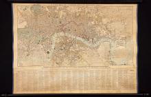
A New Map of London, 1829.
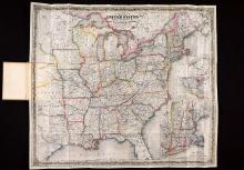
Colton's Route-Book Through the United States of America and the Canadas, 1850.
GEORGIA. (1808), Daniel Sturges, Surveyor General (Manuscript)
Haro and Rosario Straits, Surveyed by Capt. G.H. Richards & The Officers of H.M.S. Plumper, 1858-9
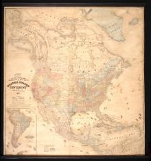
Lloyd's Topographical Railway Map of North America or the United States Continent in 1900 Projected by J.T. Lloyd
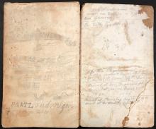
Manuscript Daybook and Diary, 1865-1867 (round trip) from New York City , around Cape Horn to San Francisco, California; to Portland, Oregon; to British Columbia; and to Anadir (Siberia), Russia,
Map of Boston for 1888.
Map of Massachusetts, Rhode Island & Connecticut, 1837
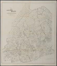
Map of Northern Maine -Lumbermen and Sportsmen 1897
Pages
1
2
3
next ›
last »
Main menu
New Inventory
General Collection
The Back Room
Events & Articles
Events
Articles
Newsletter Signup
We Buy Maps
About
Contact
New Inventory
General Collection
The Back Room
Events & Articles
Events
Articles
Newsletter Signup
We Buy Maps
About
Contact
Search form
Search