Skip to main content
Search form
Search
New Inventory
General Collection
The Back Room
Events & Articles
Events
Articles
Newsletter Signup
We Buy Maps
About
Contact
Exploration
Pages
« first
‹ previous
1
2
Haro and Rosario Straits, Surveyed by Capt. G.H. Richards & The Officers of H.M.S. Plumper, 1858-9
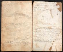
Manuscript Daybook and Diary, 1865-1867 (round trip) from New York City , around Cape Horn to San Francisco, California; to Portland, Oregon; to British Columbia; and to Anadir (Siberia), Russia,
Map of The New York Wilderness and The Adirondacks, 1874
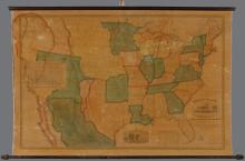
Map of the United States of America with its Territories & Districts. Including also a part of Upper & Lower Canada and Mexico. [ First 1850 edition]
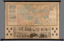
Phelps & Ensign's Travellers' Guide, and Map of the United States, 1845
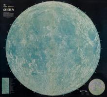
Rand McNally Official Map of the Moon [3-D ed.] 1969
Space Age (1959)
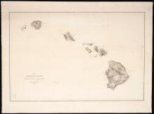
United States Exploring Expedition. Lot of 15 Individually Published South Seas navigation charts. Capt.Charles Wilkes U.S. Navy calling card with manuscript ink inscription.
Pages
« first
‹ previous
1
2
Main menu
New Inventory
General Collection
The Back Room
Events & Articles
Events
Articles
Newsletter Signup
We Buy Maps
About
Contact
New Inventory
General Collection
The Back Room
Events & Articles
Events
Articles
Newsletter Signup
We Buy Maps
About
Contact
Search form
Search