Skip to main content
Search form
Search
New Inventory
General Collection
The Back Room
Events & Articles
Events
Articles
Newsletter Signup
We Buy Maps
About
Contact
Geography
Pages
« first
‹ previous
…
2
3
4
5
6
7
8
9
10
next ›
last »
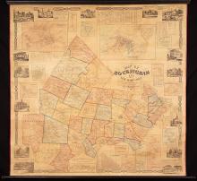
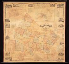
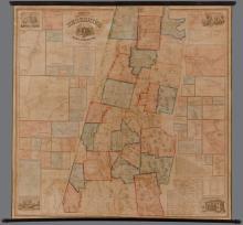
Map of Rockingham Co. New Hampshire ,1857
Map of Rockingham Co., New Hampshire, 1857
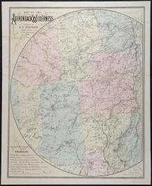
Map of the Adirondack Wilderness Compiled by S.R. Stoddard.1882 - second edition
Map of the City of Boston, 1910
Map of the City of Providence, Rhode Island (1896)
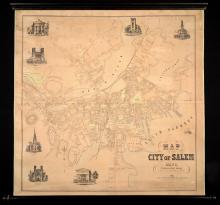
Map of the City of Salem, Mass. From An Actual Survey H.McIntyre 1851.
Map of the County of Berkshire Massachusetts. 1858.
Map of The County of Bristol Massachusetts. From Actual Surveys 1858.
Map of The New York Wilderness and The Adirondacks, 1874
Map of the Rocky Mountain Region Showing Forest Areas and Irrigation Ditches in 1885.
Pages
« first
‹ previous
…
2
3
4
5
6
7
8
9
10
next ›
last »
Main menu
New Inventory
General Collection
The Back Room
Events & Articles
Events
Articles
Newsletter Signup
We Buy Maps
About
Contact
New Inventory
General Collection
The Back Room
Events & Articles
Events
Articles
Newsletter Signup
We Buy Maps
About
Contact
Search form
Search